|
PoliPrepHub
Making Political Science Easy
|
poliprephub.in |
International Relations of South Asia
Borders and Boundaries in South Asia: Colonial Legacies and Disputes
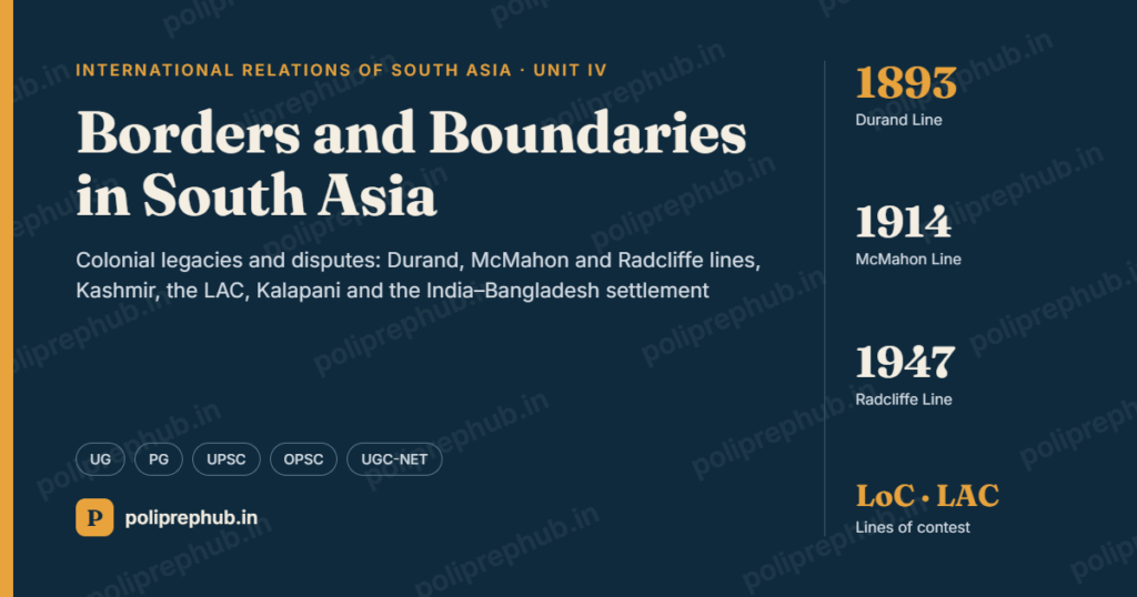
South Asia is a region of contested borders. Almost every state in the region has an unsettled or disputed boundary with at least one neighbour. India alone shares land borders with seven countries (Pakistan, China, Nepal, Bhutan, Bangladesh, Myanmar and Afghanistan, the last through Pakistan-administered territory it claims) and maritime boundaries with Sri Lanka, the Maldives, Bangladesh, Pakistan, Myanmar, Thailand and Indonesia. Many of these lines were drawn by the British colonial state, often for imperial strategy rather than local realities. After independence, the new states inherited these lines and treated them as sacred markers of sovereignty and national identity.
This topic examines how the borders of South Asia were made, the major boundary disputes, and why borders remain a central issue of regional security.
Key concepts: frontier, boundary and border
Students must distinguish three related terms.
| Term | Meaning | Example |
|---|---|---|
| Frontier | A zone or belt of territory, often sparsely settled, between two political units; outward-looking and loosely controlled | The North-West Frontier of British India; the Himalayan frontier before the 20th century |
| Boundary | A precise line that legally separates the territory of two states; inward-looking | The Radcliffe Line |
| Border | The area on both sides of a boundary, including the people and institutions that live with it (borderland) | The Punjab or Bengal borderlands |
- Lord Curzon, in his Romanes Lecture “Frontiers” (1907), described frontiers as “the razor’s edge” on which questions of war and peace hang.
- Ladis Kristof (The Nature of Frontiers and Boundaries, 1959) explained that a frontier is a zone that faces outward, while a boundary is a line that faces inward and marks the limit of sovereignty.
Stages of boundary making
The geographer Stephen B. Jones (1945) described four stages:
- Allocation: a political decision dividing territory (for example, Partition in 1947).
- Delimitation: describing the boundary line in a treaty or on a map.
- Demarcation: physically marking the line on the ground with pillars or fences.
- Administration: managing the boundary (customs, policing, maintenance).
Many South Asian disputes arise because a boundary was allocated or delimited but never properly demarcated, or because the treaty description (for example, the source of a river or a watershed) is unclear on the ground.
Theoretical approaches
- Realist view: borders are about territory, power and security. States fight to defend or expand territory, which is a major cause of war.
- Constructivist and critical views: borders are social constructions tied to national identity. Territory becomes “sacred”, making compromise politically difficult. Sankaran Krishna argued that Indian nationalism has a strong “cartographic anxiety” – deep concern over the map of the nation.
- Border studies and borderlands: scholars such as Willem van Schendel (The Bengal Borderland, 2005) show how people living at borders experience them through trade, kinship, smuggling and everyday negotiation, not only as lines of security.
- Postcolonial view: South Asian borders are a colonial legacy; their arbitrariness explains many conflicts.
Table of Contents
The Colonial Making of South Asian Borders
The British drew the borders of South Asia in two phases: the external frontiers of the Raj in the 19th and early 20th centuries, and the internal partition of 1947.
British frontier strategy
- British India’s frontier policy was shaped by the “Great Game” with Russia in Central Asia. The aim was to create buffer states (Afghanistan, Tibet, Nepal, Bhutan) and secure defensible natural barriers.
- There were two schools: the “forward policy” (push the frontier outward) and “masterly inactivity” (stay within defensible limits).
- The result was a system of layered frontiers: directly ruled territory, tribal areas, protected states and buffer states.
The Durand Line (1893)
- Drawn by an agreement between Sir Mortimer Durand, Foreign Secretary of British India, and Amir Abdur Rahman Khan of Afghanistan on 12 November 1893.
- About 2,600 km long, it separated British India (now Pakistan) from Afghanistan.
- It divided the Pashtun (and Baloch) tribes between the two sides.
- Afghanistan has never formally accepted it as an international border. Afghan governments argue it was imposed and expired, or applied only to spheres of influence. Pakistan considers it a settled international border inherited in 1947.
- In 1947 Afghanistan was the only country to vote against Pakistan’s admission to the UN, over the Pashtunistan issue.
The McMahon Line (1914)
- Drawn at the Simla Conference (1913–14) between British India, Tibet and China. Sir Henry McMahon and the Tibetan representative Lonchen Shatra agreed the line in an exchange of notes in March 1914.
- It runs about 890 km along the crest of the Eastern Himalayas, broadly following the watershed principle, from Bhutan to Burma.
- China initialled but did not ratify the Simla Convention and has never accepted the McMahon Line, arguing that Tibet had no authority to sign treaties.
- India treats it as the legal boundary in the Eastern sector (Arunachal Pradesh). China claims about 90,000 sq km south of the line, calling it “Zangnan” (South Tibet).
The western sector lines
- In the west (Ladakh–Xinjiang–Tibet), the British never fixed a single line.
- The Johnson Line (1865), drawn by surveyor W. H. Johnson, placed Aksai Chin within Kashmir. India’s claim is broadly based on it.
- The Macartney–MacDonald Line (1899), proposed to China, placed most of Aksai Chin in China. China did not respond to the proposal.
- This ambiguity is the root of the western sector dispute.
Treaties with the Himalayan kingdoms
- Treaty of Sugauli (1816) after the Anglo-Nepalese War: fixed Nepal’s western boundary at the Kali (Mahakali) river. The dispute over the river’s source is the basis of the Kalapani issue.
- Treaty of Sinchula (1865) with Bhutan, after the Duar War: Bhutan ceded the Duars to British India.
- These treaties were later replaced by independent India’s 1950 Treaty of Peace and Friendship with Nepal and the 1949 Treaty with Bhutan (revised in 2007).
Partition and the Radcliffe Line (1947)
- The Indian Independence Act, 1947 provided for two dominions. Two Boundary Commissions, for Punjab and Bengal, were chaired by Sir Cyril Radcliffe, a British lawyer who had never visited India before.
- Radcliffe had about five weeks, outdated maps and census data. The criteria were “contiguous majority areas” of Muslims and non-Muslims, along with “other factors” (communications, rivers, economic units).
- The award was ready by 12 August but published only on 17 August 1947, after independence.
- Consequences:
- It divided Punjab and Bengal, cutting through villages, rivers, canals and railways.
- It triggered one of the largest migrations in history (about 12–15 million people) and massive communal violence, with estimates of deaths ranging from several hundred thousand to around two million.
- Disputes such as the allocation of Gurdaspur (which gave India land access to Kashmir) and the Chittagong Hill Tracts (given to Pakistan despite a non-Muslim majority) remain controversial.
- It created East Pakistan separated by over 1,600 km of India, a source of later conflict (1971).
- The princely states (over 560) had to accede to India or Pakistan. Disputes over Junagadh, Hyderabad and Jammu and Kashmir followed.
The colonial legacy: a summary
| Line | Year | Between | Status today |
|---|---|---|---|
| Sugauli boundary | 1816 | Nepal–British India | Kalapani dispute with India |
| Durand Line | 1893 | Afghanistan–British India | Rejected by Afghanistan |
| McMahon Line | 1914 | Tibet–British India | Rejected by China |
| Johnson / Macartney–MacDonald | 1865 / 1899 | Kashmir–Xinjiang/Tibet | Aksai Chin dispute |
| Radcliffe Line | 1947 | India–Pakistan (Punjab, Bengal) | Accepted, but legacy of Partition |
The colonial origin of these lines explains why many South Asian disputes are about the interpretation of old treaties and maps, and why post-colonial states see any compromise as a threat to national identity.
India–Pakistan Boundary Disputes
The India–Pakistan border is about 3,300 km long and has several distinct segments: the International Border (IB) from Gujarat to Jammu, the Line of Control (LoC) in Jammu and Kashmir, and the Actual Ground Position Line (AGPL) at Siachen.
Kashmir and the Line of Control
Origins
- In 1947 Maharaja Hari Singh of Jammu and Kashmir delayed accession. After tribal raiders backed by Pakistan entered the state in October 1947, he signed the Instrument of Accession to India on 26 October 1947.
- India took the matter to the UN Security Council in January 1948. UNSC Resolution 47 (1948) called for Pakistan’s withdrawal, a reduction of Indian forces, and a plebiscite. The sequence was never implemented, and each side blames the other.
- The Karachi Agreement (July 1949) set up a Ceasefire Line (CFL), monitored by the UN Military Observer Group in India and Pakistan (UNMOGIP).
- After the 1971 war, the Simla Agreement (2 July 1972) converted the CFL into the Line of Control (about 740 km). Both sides agreed not to alter it unilaterally and to settle differences bilaterally.
Competing positions
| India | Pakistan |
|---|---|
| Accession of 1947 was legal and final; the whole of J&K, including Pakistan-administered areas and Gilgit-Baltistan, is Indian territory | Accession was invalid; Kashmir’s future should be decided by plebiscite under UN resolutions |
| The issue is bilateral under the Simla Agreement; no third-party role | The issue is international; seeks mediation |
| Cross-border terrorism is the core problem | The “Kashmir dispute” is the core issue |
Later developments
- Shaksgam Valley: under the 1963 China–Pakistan Boundary Agreement, Pakistan ceded about 5,180 sq km of territory to China. India rejects the agreement.
- August 2019: India revoked the special status under Article 370 and reorganised the state into two Union Territories (J&K and Ladakh). Pakistan downgraded diplomatic ties.
- LoC ceasefire: agreed in 2003, often violated, recommitted in February 2021; came under severe strain in the 2025 conflict.
Siachen Glacier
- The Karachi Agreement and Simla Agreement described the line only up to grid point NJ 9842, beyond which it ran “thence north to the glaciers”. The area beyond was left undefined.
- India argues the line should follow the Saltoro Ridge (watershed); Pakistan argues it should run north-east to the Karakoram Pass.
- In April 1984 India launched Operation Meghdoot and occupied the Saltoro Ridge. Since then the two armies have faced each other at altitudes over 6,000 m, in the world’s highest battlefield.
- Negotiations in 1989 and 1992 came close to a settlement, but India insisted on authentication of current positions (AGPL) before any withdrawal, which Pakistan did not accept.
- A ceasefire has largely held since 2003. Most casualties have come from weather and altitude.
Sir Creek
- A 96 km tidal estuary in the Rann of Kutch marshlands between Gujarat and Sindh.
- The dispute concerns the interpretation of a 1914 resolution of the Bombay government. Pakistan claims the boundary runs along the eastern bank of the creek; India claims it runs along the mid-channel, using the Thalweg principle (the middle of the navigable channel).
- An earlier dispute over the Rann of Kutch led to fighting in 1965 and was settled by an international tribunal in 1968, which gave about 90% of the area to India.
- Importance: Sir Creek affects the land terminus of the boundary and therefore the maritime boundary and Exclusive Economic Zone (EEZ) in the Arabian Sea, with possible oil and gas resources. It also affects fishermen, who are often arrested by both sides.
- It is considered “low-hanging fruit” that could be solved by technical talks, but progress has stalled with the wider relationship.
The International Border
- The IB in Punjab, Rajasthan and Gujarat is broadly settled and has been fenced and floodlit by India since the 1980s–1990s.
- In Jammu, India calls the boundary the IB, while Pakistan calls it a “working boundary”, reflecting the Kashmir dispute.
India–China Boundary Dispute
The India–China boundary is about 3,488 km long according to India (China gives a shorter figure of around 2,000 km, because it does not count the boundary of Pakistan-administered areas). It is not demarcated; the two armies are separated by the Line of Actual Control (LAC), whose exact alignment is itself disputed in many places.
The three sectors
| Sector | Area | Nature of dispute |
|---|---|---|
| Western | Ladakh (Aksai Chin) | China controls about 38,000 sq km of Aksai Chin, claimed by India; China built the Xinjiang–Tibet highway through it in the 1950s |
| Middle | Himachal Pradesh, Uttarakhand | Relatively minor differences; maps were exchanged in 2002 |
| Eastern | Arunachal Pradesh (and Sikkim) | China claims about 90,000 sq km, rejecting the McMahon Line; Sikkim boundary settled by the 1890 Anglo-Chinese Convention |
History of the dispute
- 1950s: China occupied Tibet (1950). India and China signed the 1954 Panchsheel Agreement on trade with Tibet, but left the boundary undiscussed.
- 1959: the Dalai Lama fled to India; clashes at Longju and Kongka Pass. Zhou Enlai proposed a swap (Chinese acceptance in the east in return for Indian acceptance in the west), which India rejected.
- 1962 War: China attacked in both sectors in October–November, then declared a unilateral ceasefire and withdrew in the east but kept Aksai Chin.
- 1967: clashes at Nathu La and Cho La in Sikkim, in which India held its ground.
- 1987: Sumdorong Chu standoff.
Agreements and mechanisms
| Year | Agreement or mechanism |
|---|---|
| 1988 | Rajiv Gandhi’s visit to Beijing; Joint Working Group set up |
| 1993 | Agreement on Maintenance of Peace and Tranquillity along the LAC (first use of “LAC” in a treaty) |
| 1996 | Agreement on Military Confidence-Building Measures (no firearms use near the LAC) |
| 2003 | Special Representatives (SR) mechanism set up |
| 2005 | Agreement on Political Parameters and Guiding Principles: a “package” settlement, taking account of settled populations |
| 2012 | Working Mechanism for Consultation and Coordination (WMCC) |
| 2013 | Border Defence Cooperation Agreement |
Recent crises
- Depsang (2013) and Chumar (2014): standoffs in Ladakh during high-level visits.
- Doklam (2017): a 73-day standoff on the Bhutan–China disputed plateau near the Siliguri Corridor (“Chicken’s Neck”), when Indian troops stopped Chinese road construction.
- Eastern Ladakh and Galwan (2020): Chinese troops moved into several points along the LAC (Galwan, Pangong Tso, Gogra–Hot Springs, Depsang, Demchok). On 15 June 2020, a clash in the Galwan Valley killed 20 Indian soldiers and an acknowledged four Chinese soldiers – the first deaths on the LAC since 1975.
- After many rounds of corps commander talks, disengagement took place at several points from 2021–22. In October 2024 India and China reached an agreement on patrolling arrangements in Depsang and Demchok, ending the main standoff.
The 2025–26 thaw and delimitation talks
- The 24th round of SR talks (August 2025) agreed to explore an “early harvest” in boundary delimitation.
- At the 25th round in Beijing on 25 August 2026, NSA Ajit Doval and Foreign Minister Wang Yi agreed that an Expert Group on Boundary Delimitation and a Working Group on Border Management under the WMCC would advance discussions on an “early and substantial harvest” of delimitation and border management. They also agreed on new military communication mechanisms, and the 26th round is to be held in India in 2027.
- “Early harvest” means settling the less disputed segments first (for example, the middle sector or Sikkim) rather than waiting for a full package settlement.
- Remember the distinction: delimitation fixes the alignment of the boundary on paper; demarcation marks an agreed boundary on the ground.
Why the India–China dispute is hard to resolve
- Different legal bases: India relies on colonial-era treaties, watersheds and traditional usage; China rejects “unequal” colonial treaties.
- Strategic value: Aksai Chin links Xinjiang and Tibet for China; Tawang has religious and strategic importance (Tawang monastery, birthplace of the sixth Dalai Lama).
- Tibet and the Dalai Lama factor, and the question of the next Dalai Lama’s succession.
- Power asymmetry and infrastructure race along the LAC (roads, airfields, “xiaokang” border villages on the Chinese side; India’s Vibrant Villages Programme).
- China–Pakistan nexus (CPEC passes through Gilgit-Baltistan, which India claims).
- Renaming: China periodically issues Chinese names for places in Arunachal Pradesh; India rejects these as having no effect on facts.
Other Boundary Disputes and Settlements in South Asia
India–Nepal: Kalapani, Lipulekh and Limpiyadhura
- The Sugauli Treaty (1816) made the Kali (Mahakali) river the western boundary of Nepal. The dispute is about where the river begins.
- Nepal says the river rises at Limpiyadhura, so all land to its east, including Kalapani and Lipulekh (about 370 sq km), belongs to Nepal.
- India says the river begins near Kalapani, so the area is part of Uttarakhand. Indian forces have been present in Kalapani since around the 1962 war.
- Trigger events:
- 2015: India and China agreed to use the Lipulekh Pass for trade; Nepal protested to both.
- November 2019: India issued a new political map after the reorganisation of J&K, showing Kalapani within India.
- May 2020: India opened a road to Lipulekh for the Kailash Mansarovar Yatra.
- June 2020: Nepal’s Parliament passed a constitutional amendment adopting a new map showing Limpiyadhura, Lipulekh and Kalapani as Nepali territory. India rejected it as an “artificial enlargement” of claims.
- 2025–26: India and China agreed in August 2025 to reopen border trade through Lipulekh, and resumed the Kailash Mansarovar Yatra through the pass. Nepal protested repeatedly, including under the new Rastriya Swatantra Party government in 2026. India rejected Nepal’s claim as “untenable”, and India–China trade through the pass began in August 2026.
- Susta (on the Gandak river, where the river has changed course) is a second, smaller dispute.
- Significance: the dispute shows how domestic nationalism in a small state and India–China bilateralism can override a smaller neighbour’s concerns.
India–Bangladesh: a success story
Land boundary
- The India–Bangladesh border is about 4,096 km, India’s longest land border.
- Partition left a complex problem: enclaves (chhitmahals) – pieces of one country completely surrounded by the other – and undemarcated stretches and adverse possessions.
- The Land Boundary Agreement (LBA) was signed by Indira Gandhi and Sheikh Mujibur Rahman in 1974, but India did not ratify it for decades.
- In 2015, India’s Parliament passed the 100th Constitutional Amendment, and the 2011 Protocol was implemented. On 31 July 2015, 111 Indian enclaves (about 17,160 acres) were transferred to Bangladesh and 51 Bangladeshi enclaves (about 7,110 acres) to India. Residents were given a choice of citizenship.
Maritime boundary
- In 2014, an arbitral tribunal under UNCLOS (Permanent Court of Arbitration) settled the Bay of Bengal maritime boundary, giving Bangladesh about 19,467 sq km of the 25,602 sq km disputed area. India accepted the award.
- Bangladesh had earlier won a case against Myanmar at the International Tribunal for the Law of the Sea (ITLOS) in 2012.
- Significance: these settlements show that South Asian border disputes can be resolved through political will and legal means.
India–Sri Lanka: Katchatheevu
- Katchatheevu is a small uninhabited island (about 285 acres) in the Palk Strait.
- Under the 1974 and 1976 maritime boundary agreements, India recognised Sri Lanka’s sovereignty over it, while Indian fishermen kept certain rights (to rest and dry nets, and pilgrimage to St Anthony’s church).
- The issue is politically sensitive in Tamil Nadu, because Indian fishermen are frequently arrested by the Sri Lankan Navy. Some Tamil Nadu parties demand that it be “retrieved”. The government of India has treated the matter as settled.
Pakistan–Afghanistan: the Durand Line conflict
- Since the Taliban returned to power in August 2021, relations have worsened. Pakistan accuses Kabul of sheltering the Tehrik-i-Taliban Pakistan (TTP), which attacks Pakistan from Afghan soil. The Taliban, like previous Afghan governments, does not recognise the Durand Line.
- Pakistan has been fencing the border since 2017, which Afghan forces have repeatedly opposed and in places pulled down.
- In October 2025, Pakistani air strikes and Afghan retaliation led to heavy clashes, followed by a ceasefire mediated by Qatar and Turkey.
- In February 2026, fighting resumed after Pakistani air strikes in Afghanistan; Afghan forces launched attacks along the Durand Line, and Pakistan’s defence minister spoke of “open war”. Clashes continued for weeks.
- Significance: this is now one of the most violent active border conflicts in South Asia, combining an unsettled colonial boundary with cross-border militancy and Pashtun nationalism.
Bhutan–China
- Bhutan has no diplomatic relations with China but has held boundary talks since 1984 (over 25 rounds).
- Disputes concern areas in the north (Pasamlung, Jakarlung) and the west (Doklam, Charithang, Sinchulungpa).
- In 2021 they signed an MoU on a “Three-Step Roadmap” to expedite boundary negotiations.
- India watches closely because Doklam overlooks the Siliguri Corridor, and reports of Chinese villages in disputed areas raise concern.
Other boundaries
- India–Myanmar (about 1,643 km): settled by a 1967 agreement, but highly porous (discussed in Topic 2).
- Pakistan–Iran: settled, but cross-border militancy in Balochistan led to Iranian and Pakistani strikes on each other’s territory in January 2024.
- India–Maldives and India–Sri Lanka maritime boundaries are settled by agreements of the 1970s.
Summary of major disputes
| Dispute | Parties | Basis | Status |
|---|---|---|---|
| Kashmir / LoC | India–Pakistan | Accession 1947 vs plebiscite claim | Unresolved |
| Siachen | India–Pakistan | Undefined line beyond NJ 9842 | Unresolved; ceasefire |
| Sir Creek | India–Pakistan | 1914 resolution; Thalweg | Unresolved |
| Aksai Chin / Arunachal | India–China | Johnson Line, McMahon Line | Delimitation talks |
| Kalapani–Lipulekh | India–Nepal | Source of Kali river (Sugauli 1816) | Unresolved |
| Enclaves / maritime | India–Bangladesh | Partition legacy | Settled (2014–15) |
| Katchatheevu | India–Sri Lanka | 1974–76 agreements | Settled; politically contested |
| Durand Line | Pakistan–Afghanistan | 1893 agreement | Not recognised by Kabul; armed clashes |
| Doklam etc. | Bhutan–China | Historical claims | Talks; 2021 roadmap |
Analysis: Why Borders Matter So Much in South Asia
Causes of border disputes
- Colonial legacy: lines drawn for imperial strategy (Great Game, buffer states) or in haste (Radcliffe) ignored geography, ethnicity and local economies.
- Ambiguous treaties and maps: unclear river sources, watersheds and undefined points (NJ 9842, the source of the Kali) allow competing interpretations.
- Nationalism and “sacred” territory: borders became symbols of identity and sovereignty after independence, so compromise is seen as betrayal. Parliamentary resolutions (India’s 1994 resolution on PoK) and constitutional maps (Nepal 2020) further limit flexibility.
- Strategic and resource value: high passes, glaciers, rivers, water, maritime zones and access corridors (Siliguri, Wakhan, Shaksgam).
- Divided peoples: Punjabis, Bengalis, Kashmiris, Pashtuns, Baloch, Nagas and Tamils live across borders, linking border issues to internal conflict.
- Power asymmetry: India’s size makes smaller neighbours fear domination; China’s power makes India cautious.
- Domestic politics: governments use border issues for nationalist mobilisation.
Consequences
- Wars: most interstate wars in South Asia (1947–48, 1962, 1965, 1999) were fought over territory, and the 2025 conflict began in Kashmir.
- Militarisation of borders and high defence spending.
- Obstacle to regional cooperation: disputes weaken SAARC and trade.
- Human costs for border communities: divided families, restricted movement, fishermen’s arrests.
Paths to settlement
- The India–Bangladesh LBA (2015) and maritime awards show that political will, domestic consensus and legal mechanisms can solve disputes.
- Technical issues (Sir Creek, the India–China middle sector, Susta) could be solved separately as “early harvests”.
- Soft borders and cross-border cooperation (trade, pilgrim corridors such as Kartarpur, opened in 2019) can reduce the significance of lines without changing sovereignty.
- Confidence-building measures (hotlines, border meetings, patrolling protocols) help manage disputes even when they cannot be solved.
Conclusion
South Asia’s borders are largely the product of British imperial strategy and the hurried partition of 1947. The Durand, McMahon and Radcliffe lines, along with older treaties like Sugauli, still shape interstate relations today. Disputes in Kashmir, Siachen, Sir Creek, Aksai Chin and Arunachal, Kalapani and the Durand Line continue to cause tension and, at times, war.
Yet the record is not entirely negative. India and Bangladesh resolved their land and maritime boundaries peacefully, and India and China have, since 2024, moved from confrontation to structured talks on delimitation. The lesson for students is that borders are not only lines of separation but also political choices: they can become sources of conflict or, with political will, zones of cooperation. A good answer should combine the realist emphasis on territory and security with the constructivist and borderland perspectives on identity and the lives of border peoples.
Quick Revision
| Item | Key fact |
|---|---|
| Sugauli Treaty | 1816; Kali river as Nepal’s western boundary |
| Durand Line | 12 Nov 1893; Mortimer Durand–Amir Abdur Rahman; ~2,600 km |
| Johnson Line | 1865; placed Aksai Chin in Kashmir |
| Macartney–MacDonald Line | 1899; proposed to China |
| McMahon Line | Simla Conference 1913–14; Henry McMahon–Lonchen Shatra |
| Radcliffe Line | Award published 17 Aug 1947 |
| Instrument of Accession (J&K) | 26 Oct 1947 |
| Karachi Agreement | July 1949; Ceasefire Line |
| Simla Agreement | 2 July 1972; CFL became LoC (~740 km) |
| China–Pakistan Boundary Agreement | 1963; Shaksgam Valley |
| Operation Meghdoot | April 1984; Siachen |
| Rann of Kutch tribunal | Award 1968 |
| India–China agreements | 1993 (peace on LAC), 1996 (CBMs), 2005 (political parameters) |
| Galwan clash | 15 June 2020 |
| Depsang–Demchok patrolling agreement | October 2024 |
| 25th SR talks | 25 Aug 2026, Beijing; “early and substantial harvest” |
| India–Bangladesh LBA | 1974; implemented 2015 (100th Amendment) |
| India–Bangladesh maritime award | 2014 (PCA) |
| Katchatheevu agreements | 1974 and 1976 |
| Nepal’s new map | Constitutional amendment, June 2020 |
One-line memory aids
- Frontier = zone; boundary = line; border = the area and people around the line.
- Stages (Jones): allocation → delimitation → demarcation → administration.
- Colonial lines: Sugauli (1816), Durand (1893), McMahon (1914), Radcliffe (1947).
Exam Practice
Long-answer questions
- “The borders of South Asia are a colonial legacy.” Discuss with reference to the Durand, McMahon and Radcliffe Lines.
- Distinguish between frontier, boundary and border. Explain the stages of boundary making with South Asian examples.
- Examine the India–China boundary dispute. Assess the prospects of an “early harvest” in boundary delimitation.
- Discuss the Kashmir, Siachen and Sir Creek disputes between India and Pakistan.
- Examine the India–Nepal boundary dispute over Kalapani and Lipulekh. What role does China play?
- “The India–Bangladesh Land Boundary Agreement is a model for resolving border disputes in South Asia.” Discuss.
- Why does the Durand Line remain a source of conflict between Pakistan and Afghanistan?
Short-answer questions
- Durand Line
- McMahon Line
- Radcliffe Award
- Line of Actual Control
- NJ 9842
- Sir Creek and the Thalweg principle
- Kalapani dispute
- India–Bangladesh enclaves
- Katchatheevu
- Doklam standoff
MCQs (UGC-NET / OPSC style)
- The Durand Line was drawn in:
- (a) 1816 (b) 1865 (c) 1893 (d) 1914
- Answer: (c)
- The McMahon Line was agreed at the:
- (a) Lahore Conference (b) Simla Conference (c) Calcutta Conference (d) Lhasa Conference
- Answer: (b)
- The Line of Control in Jammu and Kashmir was established by the:
- (a) Karachi Agreement (b) Tashkent Declaration (c) Simla Agreement (d) Lahore Declaration
- Answer: (c)
- The Kalapani dispute between India and Nepal is based on differing interpretations of the:
- (a) Treaty of Sinchula (b) Treaty of Sugauli (c) Treaty of Titalia (d) 1950 Treaty of Peace and Friendship
- Answer: (b)
- India’s Parliament passed the Land Boundary Agreement with Bangladesh through the:
- (a) 99th Amendment (b) 100th Amendment (c) 101st Amendment (d) 103rd Amendment
- Answer: (b)
- The principle that a river boundary follows the middle of the navigable channel is called the:
- (a) Watershed principle (b) Thalweg principle (c) Uti possidetis (d) Median line
- Answer: (b)
- Match the following:
- A. Johnson Line – 1. 1947
- B. Radcliffe Line – 2. 1865
- C. Simla Agreement – 3. 1963
- D. China–Pakistan Boundary Agreement – 4. 1972
- Answer: A-2, B-1, C-4, D-3
- Assertion (A): Afghanistan does not recognise the Durand Line as an international border. Reason (R): The line divided Pashtun tribes and was drawn by the British colonial government.
- Answer: Both A and R are true, and R is the correct explanation of A.
- The 73-day Doklam standoff of 2017 took place on territory disputed between:
- (a) India and China (b) Bhutan and China (c) Nepal and China (d) India and Bhutan
- Answer: (b)
- The author of The Nature of Frontiers and Boundaries (1959) is:
- (a) Lord Curzon (b) Stephen Jones (c) Ladis Kristof (d) Willem van Schendel
- Answer: (c)
Suggested readings
- Willem van Schendel, The Bengal Borderland: Beyond State and Nation in South Asia.
- Neville Maxwell, India’s China War (for a critical view) and Srinath Raghavan, War and Peace in Modern India (for a balanced view).
- Shivshankar Menon, Choices: Inside the Making of India’s Foreign Policy.
- A. G. Noorani, India–China Boundary Problem 1846–1947.
- Sankaran Krishna, “Cartographic Anxiety: Mapping the Body Politic in India”.
- Joya Chatterji, “The Fashioning of a Frontier: The Radcliffe Line and Bengal’s Border Landscape”.
- Rajat Ganguly (ed.), Autonomy and Ethnic Conflict in South and South-East Asia.
Sources for recent developments
- 25th Round of Special Representatives’ Talks: joint outcome (Ministry of Foreign Affairs, China, August 2026)
- India, China rare joint text on “early and substantial harvest” (The Wire)
- India, China begin trade through Lipulekh Pass despite Nepal’s objections (The Star / Kathmandu Post, August 2026)
- India rejects Nepal’s territorial claim as “untenable” (TBS News, May 2026)
- Timeline: How Pakistan–Afghanistan tensions reached a breaking point (Anadolu Agency)
- Pakistan, Afghan forces clash after days of hostilities (Khaleej Times, February 2026)
© PoliPrepHub · Generated on November 19, 2026